Geobeacon localization
Insights on how Sensolus trackers use Bluetooth geobeacon technology for localization.
Geobeacon localization is a BLE localization technology based on the detection of transmitted signals from known geobeacons that are installed at fixed locations. The IDs and locations of the geobeacons are entered in the Sensolus platform.
The geobeacon periodically sends a BLE signal containing its ID. When a tracker is in the vicinity of the geobeacon, the ID is registered and sent to the Sensolus platform by the tracker . The platform can resolve the geobeacon ID to the configured location.
Different localization technologies have different characteristics. Localization using geobeacons is particularly useful in indoor situations where GPS localization doesn't work. Although, there are also very good reasons to use geobeacons outdoors as well:
- Localization using geobeacons is 5 times more energy efficient than GNSS localization.
- Geobeacons can result in an higher location accuracy compared to GNSS or Wi-Fi localization.
Functioning of Sensolus geobeacons
When a tracker performs a geobeacon localization, it will scan for nearby Sensolus geobeacons and report the IDs of the geobeacons to Sensolus platform.
This works as following: the locally installed geobeacon periodically emits a BLE signal which contains a unique number (UID) and which is registered by the tracker. This geobeacon UID is then sent over the LPWAN network to the Sensolus platform where it is resolved to a location. For this to work properly, the location of each geobeacon must have been correctly entered in the platform.
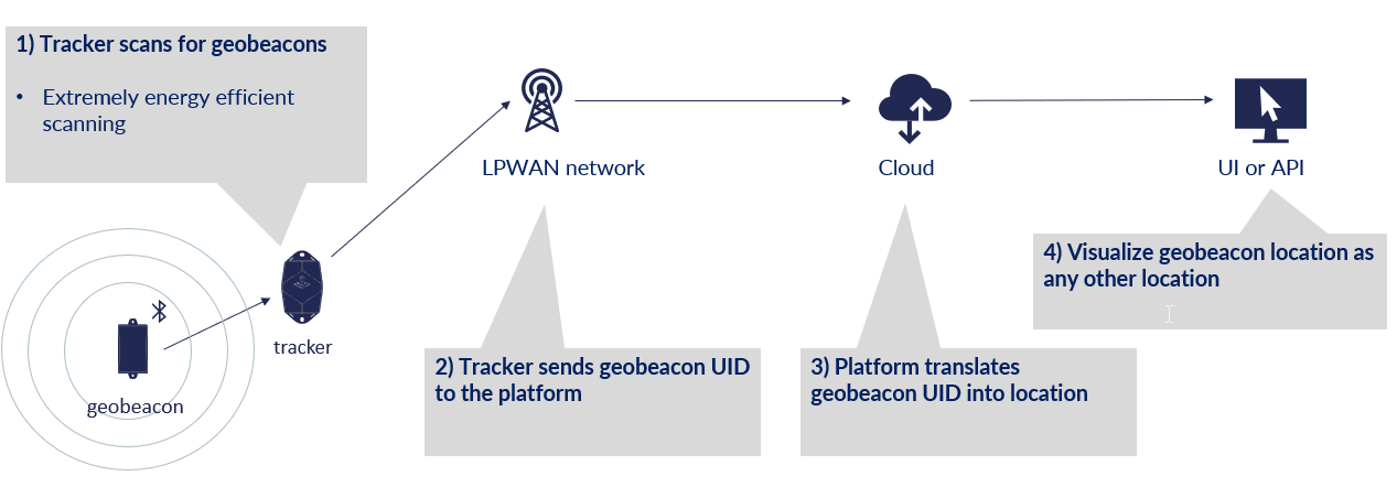
Sensolus geobeacons
Geobeacon transmission power
- range 0: -40dBm / 2 meter
- range 1: -20dBm / 7 meter
- range 2: -16dBm / 10 meter
- range 3: -12dBm / 15 meter
- range 4: -8dBm / 22 meter
- range 5: -4dBm / 27 meter
- range 6: 0dBm / 50 meter
- range 7: +4dBm / 100 meter
Geobeacon location capture
When a location capture is triggered, the tracker will scan for nearby geobeacons for a predetermined duration. When it finds at least one beacon, the tracker will send a location message with information for up to two detected beacons.
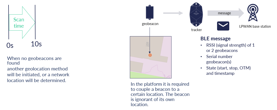
Geobeacon usage and installation
The diagram below shows two options for an given area. The geobeacon can be placed in the middle (For example: on the ceiling) or two geobeacons could be placed on the edges.
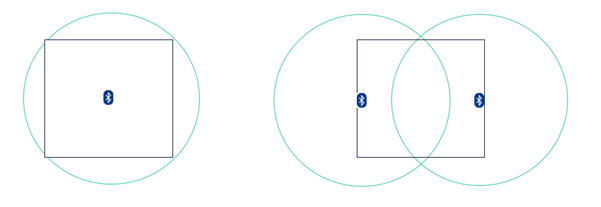
If there are no other geobeacons nearby, the left option is recommended. If there would be other neighboring zones nearby, the right option is better because it 'offers' 2 correct geobeacons to detect. There are also a few strategies that can be leveraged to control how far the signal of the geobeacons reaches. The signal strength of the geobeacons can be configured, which can be used as a mechanism to control how 'snappy' a location is.
Depending on the configured signal strength and the presence of physical obstructions around the geobeacon, the signal reach of a geobeacon can vary between 2 and 100 meters. The material on which the geobeacon is mounted, as well as its orientation, are important too. Mounting a geobeacon on a metal surface facing inwards will significantly reduce the signal towards the backside. The picture blow shows this effect:
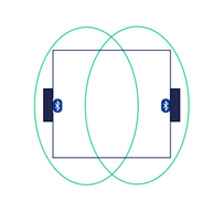
A suggested geobeacon installation diagram for a larger area (for example: an industrial hall) is shown in the figure below:
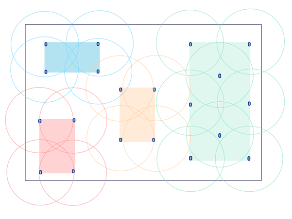
In this example, the hall has 4 zones of interest which are each covered with sufficient geobeacons.
Trackers with geobeacon localization functionality
On the list with Sensolus trackers you can see which tracking devices contain the geobeacon localization functionality.